Mt. Pico De Loro Day Hike
I don't know where to start.
I am completely dumbfounded and utterly clueless how to blog my experience in climbing Mt. Palay Palay a.ka. Mt. Pico De Loro.
What I can tell point blank; It's my hardest climb to-date! (October 11, 2014)
#PicoDeLoroFacts
In the early days, the Spaniards saw a form of a giant parrot, perched in the forested mountains in Cavite while aboard their galleons. They named it "Pico de Loro" - "Parrot's Beak".
 |
| The Monolith of Mt. Palay Palay |
According to the locals, the monolith is part of Batangas while Parrot's beak is part of Cavite. These two land masses serves as the borderline to those provinces.
Maragondon, Cavite and Nasugbu, Batangas
Minor jump-off: Ternate-Nasugbu Highway, Nasugbu, Batangas
LLA: 14° 12.855 N; 120° 38.785 E; 664 MASL
Days required / Hours to summit: 1-2 days / 2-5 hours
Specs: Minor climb, Difficulty 3/9, Trail class 1-3
Features: Distinctive spire at the summit, forests, scenic views of Cavite
Last updated: February 23, 2015
source: pinoymountaineer.com
#TeamBidaBida
This hike have been drawn in air too many times. So when the right timing came, I packed up my bag and left without a second thought. "Kahit dalawa lang tayo ate, Game ako!" I told ate @traveladik.
So we pushed through this day hike without qualms. Rode the bus from Coastal Mall to Ternate, Cavite (82 pesos) then road a 225 peso tricycle ride to DENR for registration (25) and to the Mt. Pico De Loro jump off point (few hundred meters away from DENR).
 |
| DENR - As of Feb 20, Major Jump Off Point |
 |
| OLD TRAIL JUMP OFF - CLOSED |
Update as of February 20, 2015:
 |
| OLD TRAIL is Closed - photo credits to Francis Reyes Jr. |
#LooksCanBeDeceiving
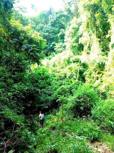
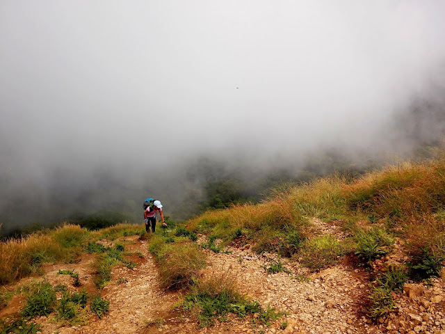
The old jump off point was quaint. Slow ascend, and it went on for more than half an hour. In our fast pace, we advanced 3 groups. We never expected (never really bothered reading hike notes from others :P) that the next part of the hike was an UP-DOWN trek! We went up an almost 70-80 degree slope then back to a steep descend and it goes on and on.
 |
| Hiking Pico De Loro |
 |
| Welcome to Pico De Loro |
 |
| Geek in Nature |
#WorthAlltheBloopers
First blooper - no ample Water
Solution: store in the camp site (after 2 and a half hour of hiking)
Second blooper - heavy bag packs
Solution: endure the Pain!
Third blooper - no Camera Man
Solution: One stays at Parrot's Beak, while the other climb the Monolith (vice versa)
Nth blooper - never assume unless otherwise stated!
Solution: "Kapit Mabuti, Ingat Palagi, at Mag ingat pa ng mas Marami!"
 |
| Climbing Up Parrot's Beak |
 |
| View Climbing Up Parrot's Beak |
 |
| Monolith On top of Parrot's Beak |
 |
| Parrot's Beak + Monolith |
 |
| traveladik climbing Monolith! |
 |
| Steep descend to the Monolith |
.jpg) |
| View from Below - Monolith facing the Parrot's Beak |
 |
| Monolith facing the Parrot's Beak |
 |
| Bug's Life on Mt. Pico De Loro |


.JPG)


Hi sir,
ReplyDeleteWe went to Pico last June this yr & overnight camping was not allowed for the mean time by that time. Do you have any idea if overnight camping is now allowed? Also, do you have contact @ pico wherein I can reach & confirm things about overnight camping. Thanks :)
Hi Regie,
DeleteAs of the moment, I don't have any updates on it, But Ill inform you if I got the contact numbers of the DENR Branch there,
Thank you
Hi Sir Dan. You went there by yourself right? Im planning to go there kasi with my girl and we both dont have experience sa trekking. Sa DENR ba kami didiretso kung may dala kaming car and may mag gguide ba? Thanks! :)
ReplyDeleteHi Gio,
DeleteI went there with a fellow hiker. Dalawa lang kami. Doable naman siya. As for guides just go to DENR.
Puede nyo na din ipark dun ung kotse.
Enjoy the trail!
Cheers!
open p b ung water falls s pico?
ReplyDeleteNice photos ! i went in pico de loro before and it was awesome.
ReplyDeletehttp://www.odysseyawaits.com/2015/06/mt-palay-palay-also-known-as-pico-de.html
Thank you sir Carl! Saw your Post! Galing. at may proposal pa!
DeleteSee you on the trails sir! More Power!
Hi if i were to bring my own car, and i decide to drive to the nasugbu side, how do i get there? Kasi from most of the blogs that i have read, they start off sa cavite, then end sa nasugbu. But the thing is, i'll be bringing my own car. So pano po kaya yung itenerary ko? Thanks sir!
ReplyDeleteHi sir Dan may signage po ba na pwedeng sundan kung maghihiking kami ng walang guide?
ReplyDelete
ReplyDeleteA COASTAL ESCAPE AWAITS.
DISCOVER PICO DE LORO.
Pico De Loro Beach & Country Club ( HAMILO COAST)
CONDO RENTALS
studio/1bedroom/2bedroom units
0916-7782878 (viber/sms)
0935-7979636
COOKING is allowed
100% secured booking